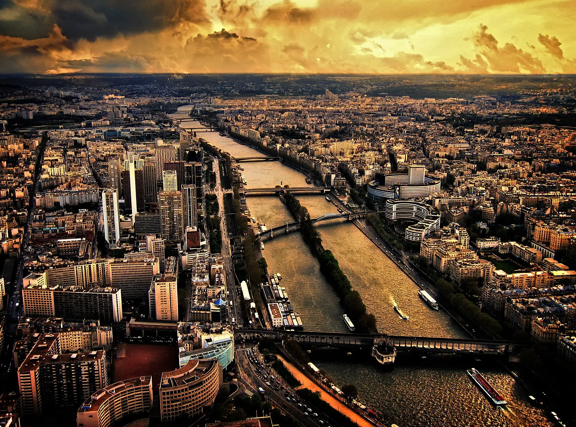
Strip away the boats, the bridges and the postcards, and the Paris Seine river is a modest waterway — a few hundred metres wide, slow, green-brown, working. Add them back and it becomes the organising line of the city: the reason the Louvre faces the water, the reason the islands exist, the reason every visitor ends up leaning on a parapet at some point wondering which bridge they are looking at.
This guide answers that question and the ones around it — the geography, the 37 bridges, the two banks and what they mean, the islands, the quays — and then connects it all to the practical part: the ways to get on, along and over the water, from an €18 boat ride on the Seine to a week-long sailing to the sea.
The geography: 777 kilometres, of which Paris gets 13
The Seine rises on a plateau in Burgundy and runs 777 kilometres northwest to the English Channel at Le Havre. On the way it collects tributaries, feeds a huge freight corridor, and passes through two cities that matter to this site: Paris, and downstream, Rouen — the route the multi-day hotel ships follow to the Normandy coast.
The stretch everyone actually means by “the Seine” is the roughly 13 kilometres inside Paris. The river enters the city in the southeast, bends north around the two islands, curves past the Louvre and the Eiffel Tower, and exits southwest. That central arc — perhaps five kilometres of it — carries an almost absurd density of landmarks: on one continuous cruise loop you pass the Musée d’Orsay, the Louvre, the Conciergerie, Notre-Dame, the Grand Palais’s glass roof and the Eiffel Tower without the boat ever hurrying.
One spelling note, since search engines see it constantly: it is the Seine, though “sienna river” appears often enough in queries that half the internet’s visitors to Paris have apparently sailed a misspelling. Same river; the pigment and the Italian hill town are innocent bystanders.
Left Bank, Right Bank: what the names actually mean
The banks are named facing downstream — the direction the water flows, toward Rouen and Le Havre. Stand looking that way and the Left Bank (Rive Gauche) is the southern side: the Latin Quarter, Saint-Germain-des-Prés, the Musée d’Orsay, the university quarter that gave the bank its bookish reputation. The Right Bank (Rive Droite) is the northern side: the Louvre, the Tuileries, the Marais, the department stores — historically the bank of commerce and power.
The cultural shorthand — intellectual left, mercantile right — is a century out of date as a literal map of Paris life, but it survives because it is useful. It also survives on the river itself: cruise commentary narrates monuments by bank, and knowing which side is which turns the audio guide from noise into orientation. (Mnemonic that works on a boat heading downstream: Left Bank, Latin Quarter, Louvre is the one it isn’t.)
The two islands
Mid-river, at the historic centre of everything, sit the only two natural islands in the Paris Seine: Île de la Cité and Île Saint-Louis.
Île de la Cité is where Paris began — the defensible river island that became the Roman town, then the medieval capital. Today it carries Notre-Dame at one end, the Sainte-Chapelle and the Conciergerie in the middle, and at its downstream tip the Square du Vert-Galant, the tree-shaded point where the central cruise pier boards under Pont Neuf.
Île Saint-Louis, a footbridge away, is its quiet sibling: seventeenth-century townhouses, one long spine of a shopping street, famous ice cream, and no monuments to queue for. From the water, the pair read as one continuous historic core — cruise loops circle them slowly, and the narrow southern channel past Notre-Dame’s flying buttresses is the closest any boat gets to any monument in Paris.
Thirty-seven bridges, four worth knowing by name
Thirty-seven bridges cross the Seine within Paris. Most are handsome, workaday and anonymous to visitors; four repay knowing on sight.
Pont Neuf (1607)
The “New Bridge” is, by the standard joke, the oldest bridge standing in Paris — finished in 1607, and revolutionary in its day for carrying no houses, just open views of the river. It crosses the tip of Île de la Cité in two spans, carries the equestrian statue of Henri IV, and hides the staircase down to the Vert-Galant cruise pier. Its rows of stone half-moon balconies are the best free river viewpoints in the city.
Pont Alexandre III (1900)
The gilded one. Built for the 1900 World’s Fair, it connects the Invalides esplanade to the Grand and Petit Palais in a single iron span dressed in lamps, cherubs and gold-leafed statuary. It is the most decorated bridge on the river and knows it — from a boat deck it fills a camera frame; from the bridge itself, the view down the river to the Eiffel Tower is the one on the posters.
Pont de Bir-Hakeim
The two-level one: road and pedestrians below, an elevated métro viaduct above, held up by an iron colonnade that filmmakers cannot leave alone. It crosses near the Eiffel Tower, which stands close enough to loom in every photograph taken through the arches — the reason the bridge’s central walkway hosts a permanent rotation of wedding shoots at dawn.
Pont des Arts
The pedestrian footbridge linking the Louvre to the Institut de France, once famous for its love locks — since removed in bulk when their weight became structural — and still famous as the picnic bridge, where the wooden deck fills with wine and paper bags every warm evening. From the water it is a modest iron line; from the deck it offers one of the finest sightlines to Pont Neuf and the island.
The other 33 pass overhead pleasantly on any cruise; the full parade of them, one every few hundred metres, is the quiet star of the one-hour sightseeing loop.
The banks: UNESCO stones, quays and green boxes
The central riverbanks — broadly the arc from the islands to the Eiffel Tower — are inscribed as a UNESCO World Heritage site, protected as a built landscape: the quays, the bridges, and the facades that face the water as one composition. It is a rare listing you can tour from a boat seat.
At street level, the parapets of the central quays carry the bouquinistes — the second-hand booksellers whose dark-green lockboxes have been bolted to the stone for generations. They sell used books, old prints, vintage magazines and an honest quantity of souvenirs; they open when they feel like it and close when the light goes. Browsing costs nothing and remains one of the last genuinely old river habits still practised daily.
Below the parapets, long stretches of the lower quays have been handed back to walkers — car-free promenades at water level where Paris jogs, picnics and dangles its feet over the river. Walking the lower quay from the Musée d’Orsay to the Eiffel Tower at golden hour is the best free river experience in the city, and the natural companion to a sunset sailing rather than a substitute for it.
The working river
It is easy to forget, amid the sightseeing fleets, that the Seine still earns its living. Barges push gravel, grain and containers through the city daily — cruise boats give way to them, and watching a 100-metre freight convoy thread the arches of a 400-year-old bridge is its own quiet spectacle. Along the quieter quays, moored houseboats form a linear village of potted gardens and bicycles lashed to gangways; people live full-time on this river, with postal addresses on the water.
That working traffic explains two things visitors notice. First, the wash: the river is never glassy, because something is always moving on it. Second, the discipline of the cruise loops — the Seine through Paris is a regulated waterway with lanes, speed limits and right-of-way rules, which is why your boat holds its line instead of wandering toward whatever monument the cameras point at.
Local tip: for the single best bank-level hour, start at Pont Neuf’s balconies 45 minutes before sunset, walk the Left Bank lower quay westward as the light drops, and be standing on Pont Alexandre III when the Eiffel Tower’s first after-dark sparkle runs — five minutes, on the hour, visible straight down the river.
Paris-Plages and the swimming question
Every summer the city trucks in sand, deckchairs and palm trees and turns stretches of the riverbank into Paris-Plages — a temporary beach resort along the quays, free to all, running through the high-summer weeks. It is resolutely municipal in spirit: no sea, but pétanque, ice cream and a river breeze.
Actually swimming in the Seine was banned for most of a century on safety and water-quality grounds — which made it the perfect symbolic prize for the 2024 Olympics, when Paris staged the Games’ opening ceremony on the river itself and Olympic events were swum in it after a vast clean-up. Since then the city has opened designated, supervised bathing sites in season. The nuance matters: swimming at the designated sites, in season, under supervision — yes; diving off a bridge on a warm night — still illegal and still a terrible idea, with commercial boat traffic overhead. Check the city’s current arrangements each summer.
Things to do on and along the Seine
The river rewards three speeds:
- Cruise it. The default, for good reason: an hour on the water passes more of Paris than a day on foot. The one-hour loop at €18 is the entry point; after dark the same loop becomes the night cruise, and with a table added it becomes lunch or a dinner cruise. Departure logistics for every format live on the practical page.
- Walk it. The lower quays, the bridges, the bouquinistes, the island circuits — free, unscheduled, best in the two hours around sunset.
- Picnic it. The Vert-Galant point, the Île Saint-Louis quays and the Pont des Arts deck are the canonical spots; a baguette dinner on warm stone beside the water costs a tenth of a boat dinner and outranks most restaurants for setting.
And for the ambitious version: the Seine keeps going. Beyond the city limits the river runs to Giverny, Rouen and the sea — a week-long cruising route on hotel ships, which is a different product at a different price and has its own guide. For the canal that branches off the river inside the city, see the Canal Saint-Martin page.
However you take it — an hour afloat, an evening on the quays, a week to the coast — the principle is the same: Paris arranged itself to face this river. Seeing the city from the water is not a detour from the sights. For most of them, it is the front row.
What we like
- The river concentrates the city: most first-tier monuments stand within sight of the water
- Free at bank level — the quays, bridges and bouquinistes cost nothing
- A one-hour cruise covers what a full day of walking covers, seated
- Every hour of the day gives a different river, from morning light to the illuminations
What to watch out for
- Summer crowds pack the prettiest quays and the most photographed bridges
- The river floods some winters, closing lower quays and pausing boat traffic
- Swimming remains restricted to designated arrangements — you cannot simply jump in
- Bank-level noise and traffic on some stretches puncture the postcard
Frequently asked questions
How long is the Seine river?
The Seine runs 777 kilometres from its source in Burgundy to the sea at Le Havre, flowing through Paris and then Rouen on its way to the Channel. The Paris stretch — the part visitors mean when they say 'the Seine' — is about 13 kilometres of river inside the city limits.
How many bridges cross the Seine in Paris?
Thirty-seven bridges cross the Seine within Paris, from road bridges to métro viaducts to pedestrian-only spans. The oldest is Pont Neuf, finished in 1607; the most decorated is Pont Alexandre III, built for the 1900 World's Fair; the most filmed is probably Bir-Hakeim, with its two levels and iron colonnade.
What is the difference between the Left Bank and Right Bank?
The names follow the direction of flow: facing downstream, the Left Bank (Rive Gauche) is on your left — the southern side with the Latin Quarter and Saint-Germain — and the Right Bank (Rive Droite) is the northern side with the Louvre, the Marais and most of the grand commerce. The labels stuck as cultural shorthand: academic and bohemian south, mercantile north.
Can you swim in the Seine in Paris?
For most of a century, no — swimming was banned for safety and water quality. A long clean-up culminated around the 2024 Olympics, when the opening ceremony took place on the river, and the city has since opened designated supervised bathing sites in season. Outside those sites, swimming remains prohibited. Check the city's current arrangements before packing goggles.
Is a Seine river cruise worth doing?
Yes, with the right expectations: it is the most efficient orientation to central Paris available, covering in an hour what takes a day on foot. The €18 sightseeing loop is the best value-per-monument ticket in the city. Choose daylight for architecture, after dark for atmosphere — or a longer format with food if you want the river to be the evening itself.
What are the green boxes along the river?
Those are the bouquinistes — the second-hand booksellers whose green lockboxes line the parapets of the central quays. They have been part of the riverscape for generations, selling used books, old prints and, increasingly, souvenirs. Browsing is free and haggling is mild; the stalls open at the seller's whim, most reliably on fine afternoons.
Is it the Seine or the Sienna river?
The river in Paris is the Seine — 'sienna river' is a common misspelling in searches, likely borrowed from the pigment or the Italian city of Siena. If you arrived here looking for the Sienna river in Paris, you are in the right place: same water, French spelling.